UN
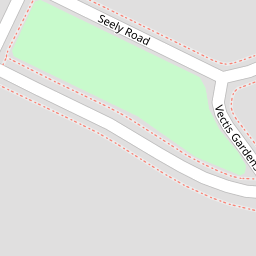
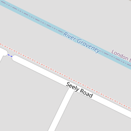
191 Seely Road
£ 535,000
Description
We don't have a Description for this property.
- Bedrooms
- 3
- Bathrooms
- 0
- Sqft
- 78.00

Leaflet © OpenStreetMap contributors
The heatmap indicates the level of crime in the area. The color of the heatmap indicates the crime severity and recency.
Metrics Year-on-Year
- Average area value
- 582,591.00 £Increased by 1.15 %
- Est sale value
- 53,586.00 £Decreased by 1.01 %
- Average area rental value
- 7,979.00 £/moIncreased by 211.31 %
- Est letting value
- 702.00 £/moIncreased by 200.00 %
- Est rental Yield
- 16.43 %Increased by 207.68 %
- Crime Rate
- 5.00 %Unchanged by 0.00 %
from 575,971.00 £
from 54,132.00 £
from 2,563.00 £/mo
from 234.00 £/mo
from 5.34 %
from 5.00 %
Nearby Schools
| Name | Type | Ofsted | Distance |
|---|---|---|---|
| Graveney School | Academy Converter | Outstanding | 0.36 KM |
| Furzedown Primary School | Community School | Good | 0.38 KM |
| Links Primary School | Community School | Good | 0.45 KM |
| Penwortham Primary School | Community School | Good | 0.59 KM |
| Beecholme Primary School | Academy Sponsor Led | Good | 0.76 KM |
Images
Nearby Streets
| Name | Average Price | Average Sqft | Distance |
|---|---|---|---|
| Hasty Close | £ 0 | 0 | 0.00 KM |
| Saint Benedict's Close | £ 335,000 | 0 | 0.00 KM |
| Meadfoot Road | £ 550,000 | 0 | 0.00 KM |
| Bruce Hall Mews | £ 0 | 0 | 0.00 KM |
| Renshaw Corner | £ 0 | 0 | 0.00 KM |
Nearby Transport
| Name | NLC | TLC | Distance |
|---|---|---|---|
| Tooting | 5389 | TOO | 1.10 KM |
| Mitcham Eastfields | 5069 | MTC | 1.37 KM |
| Streatham Common | 5384 | SRC | 1.70 KM |
| Streatham | 5383 | STE | 2.29 KM |
| Balham | 5399 | BAL | 2.63 KM |
Nearby Listings
| Address | Price | Type | Score | Distance |
|---|---|---|---|---|
| Vectis Road, London, SW17 | £ 425,000 | BUY | 5 / 10 | 0.07 KM |
| Vectis Gardens, Tooting | £ 750,000 | BUY | 7 / 10 | 0.08 KM |
| Links Road, Tooting, SW17 | £ 899,950 | BUY | Unknown | 0.12 KM |
| Nimrod Road, London, SW16 | £ 285,000 | BUY | Unknown | 0.15 KM |
| Links Road, London, SW17 | £ 715,000 | BUY | Unknown | 0.15 KM |
Nearby Properties
| Address | Price | Distance |
|---|---|---|
| 211 Seely Road | £ 640,000 | 0.00 KM |
| 193 Seely Road | £ 225,000 | 0.00 KM |
| 191 Seely Road | £ 535,000 | 0.00 KM |
| 195a Seely Road | £ 215,000 | 0.00 KM |
| 197 Seely Road | £ 395,000 | 0.00 KM |